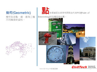
點幾何通常用於描述特定的資產空間位置,例如:有興趣的點POI、或是位置、或是資產(如消防栓、電箱、電桿)等。點幾何相當簡單描述,可以只用X、Y、Z座標值代表空間位置。在我們深活當中,很多事務可以用點幾何來存放,成為GIS資料的一部分;當然,用點幾何儲存也最簡單最方便,只要用記事本將座標標定,再加入名稱與描述,就是一個GIS軟體可以處理的點資料。
值得一提的是,GIS資料中,並沒有特定文字資料格式的存在。文字資料被規範在點資料內。但是,像MapInfo Professional 軟體就將文字資料單存提出來作定義。
GIS represent the Phenomenon by different geometry, such as Point, Line, and Polygon. Point data usually be used for POI, Property, and specify location, etc. The Geometry of Point is very easy to be defined by text file or table which only need recording the X, Y, Z value and properties.

線幾何
線幾何通常用於描述道路中心線、維生管線資料等,其實相當簡單,這裡筆者不加以贅述。唯一要分享的經驗是,很多過去所建立的GIS資料,或是一般使用者自行建立的CAD圖資,都常用單一的"線"來描述線型資料,如道路或管線;其實,建議大家少用單一的"線"來製作資料。真正的GIS資料建立時要考量資料的完整性,以及是否可以真正的反映出實際的空間幾何,所以如果是連續的資料,如道路,建議大家還是使用"聚合線"來建置。
The Line geometry always be used for Road, utility, live line data.
Most of CAD user create line object by "line" in CAD or GIS software. that is a very bad idea, cause line object will increase file size and not easy to clean up for GIS usage. So, I strongly recommend you create by Polyline.

面幾何
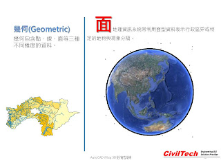
面形資料通常用於區域、不連續性的資料建立。如行政區域、流域、建物邊界等。在建立面形資料時,要注意物件幾何是否完整。
Polygon object display a region or discontinue Phenomenon, such as boundaries, river, town, etc. The Polygon geometry is harder than point and line geometry creation, you should consider about the topology issue.

圖形套疊
圖形套疊,就是將點、線、面資料套在一起。當然,GIS的幾何套疊時,有上下順序之分,一般都以點、線、面為資料順序。因為,較為早期的GIS軟體沒有透明度的設定,因此,將面形資料放置於點與線型資料的上方,將會覆蓋住點與線的顯示。
Finally, the overlapping point, line, and polygon layers in same map in same coordinate system. Right now, most of GIS software support transparency for layers display, so you don't worry about the order of overlapping.

後續的文章會講到空間資料的格式部分,會再將點線面以拓樸理論詳加說明,因此,在本文當中,讀者可以自行思考在日常的作業中哪些資料可以用點、線、面來描述,建立GIS空間資料。
Well, I will continue update this section of Introduction GIS recently. And in coming up Topology section you can learn more about how GIS define the geometry, and how it connected with attribute.


沒有留言:
張貼留言