首先你要先安裝"globelinkforrevit2009-20080903.exe"程式。
First of all, you need install "globelinkforrevit2009-20080903.exe".
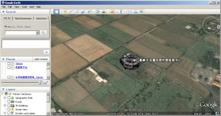
And then you need find out the place that your building located. You can mark a POI in Google Earth, and then get the Lat, Long from properties.
然後到Google Earth查詢你要發佈的建築物的位置!你可以先建立一個標記點位,然後,再到性質裡面去修改位置,觀看標定點位的經緯度座標值。(這部分就是Engineering GIS)
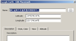
然後簡單寫一個Excel的轉換程式,將度分秒的經緯度值,轉換成小數(Revit只接受這樣的定義)
Then, you can create a Execel program to convert Lat&Long from dd/mm/ss to degree.

接下來,去Revit中的"設定->管理地點和位置"修改專案位置。
And then, Visit Revit "設定->管理地點和位置" to change project location.
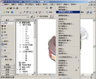
將你Excel的值Copy進來!
Copy and past the lat Long value.
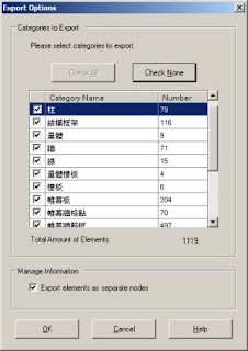
Export Options中勾選你要發佈的物件(當然,發布愈多物件檔案愈大,一般預設的系統發怖,會控制在1M以下的檔案,在Google Earth中執行很快)
Select Object what you want export to Google Earth. The Defult settings, will keep the file size under 1Mb.
Finally, you can browser the Model form Google Earth.
操作心得:
1. Revit發布至Google Earth算是相當突破的設計概念,可以結合Google Earth來作展示與區域規劃的說明,對於工程GIS化跨進了一大步。
2. 但是Revit 完整的模型(估計三層樓建物)發布至Google Earth時,展示速度很慢,很容易當機。
3. 建議如果是要像其他Google Earth 3D建物模型一樣快的展示,建議只要發佈建物外觀即可。
4. 其實如果建築師可以在設計的時候考量GIS座標系統的概念,就可以更加精準的將模型發布至現地。
5. 模型再發布前,可能要考慮與正北的夾角問題,我還是用很傳統的旋轉方式去調整,不知道有沒有先進可以教我比較聰明的做法。
6. 要模型、外掛程是來找我吧!不過外掛程式只能用在2009版程式。


沒有留言:
張貼留言