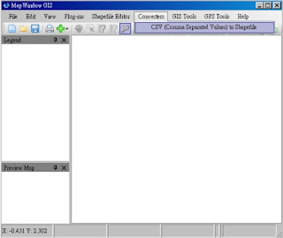
1. Open the MapWindows GIS software, and click the "Converter->CSV to Shapefile".

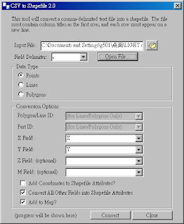
2. The System will open the CSV to Shapefile Dialog, you can click the Browser icon form Input File.

3. Choose the CSV file and click "OK" for opening.

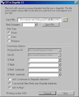
4. Click "Open File" and click "Point" for Data Type. Finally, click "Convert" to convert the CSV to Shapefile

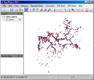
5. You will see the Point data in the screen of MapWindows GIS.


沒有留言:
張貼留言